Tysons: An Edgier City
Ultimately Urban
Spring 2020 | Professor Mona El Khafif
Software: GIS, ArcMap, Rhino, Grasshopper, GH Plug-Ins, Adobe Creative Cloud Suite
Hardware: Laser Cutter, Plexi-Glass, Paper, Threaded Rod, Nuts, Washers
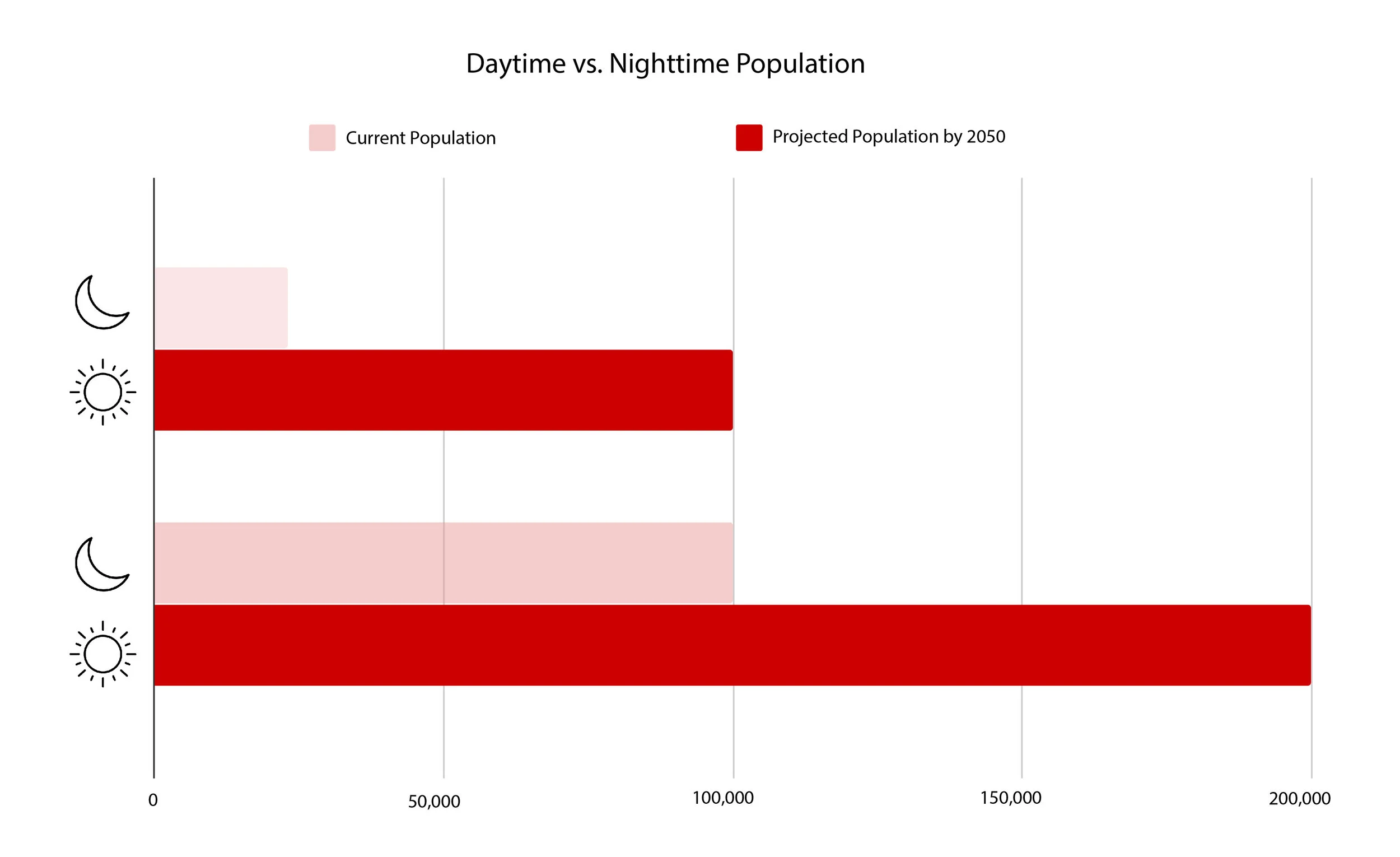
In 1991, Joel Garreau coined the term ‘edge cities’ based on the 30 year transformation of Tysons, VA, from farmland to office, tech, and retail hub of Fairfax County. A lack of residential space, construction around highways, and location between Dulles International Airport and Washington D.C. were also key factors in its designation. Today, Tysons is in the midst of a 40 year urbanization plan that projects an expected population growth of 400%, four Washington Metro stops, and future metro connectivity to Dulles.
01. Historical Context
Tysons Through the Years:
1937, 1953, 1960, 1976, 1980, 1990, 2007, and 2019
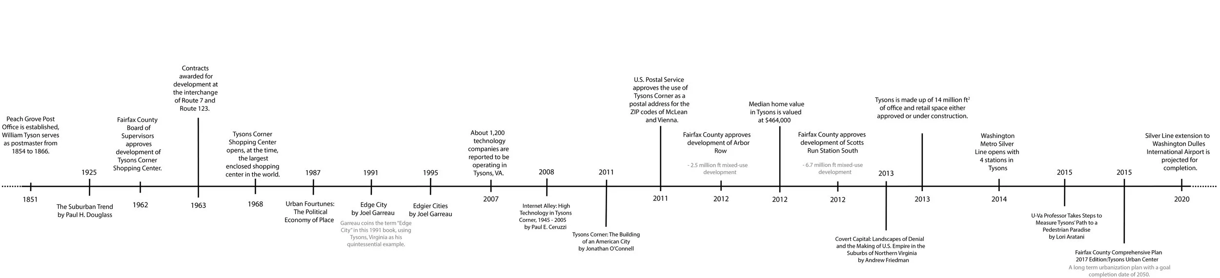
Timeline of key events in Tysons' development history.
02. Current Conditions
Investigations of the current condition of Tysons have highlighted the impact major roads and interstate highways have on the area - creating boundaries around "islands" of development. This also makes the space incredibly difficult to navigate and enjoy as a pedestrian, in addition to the lack of long-term programming.
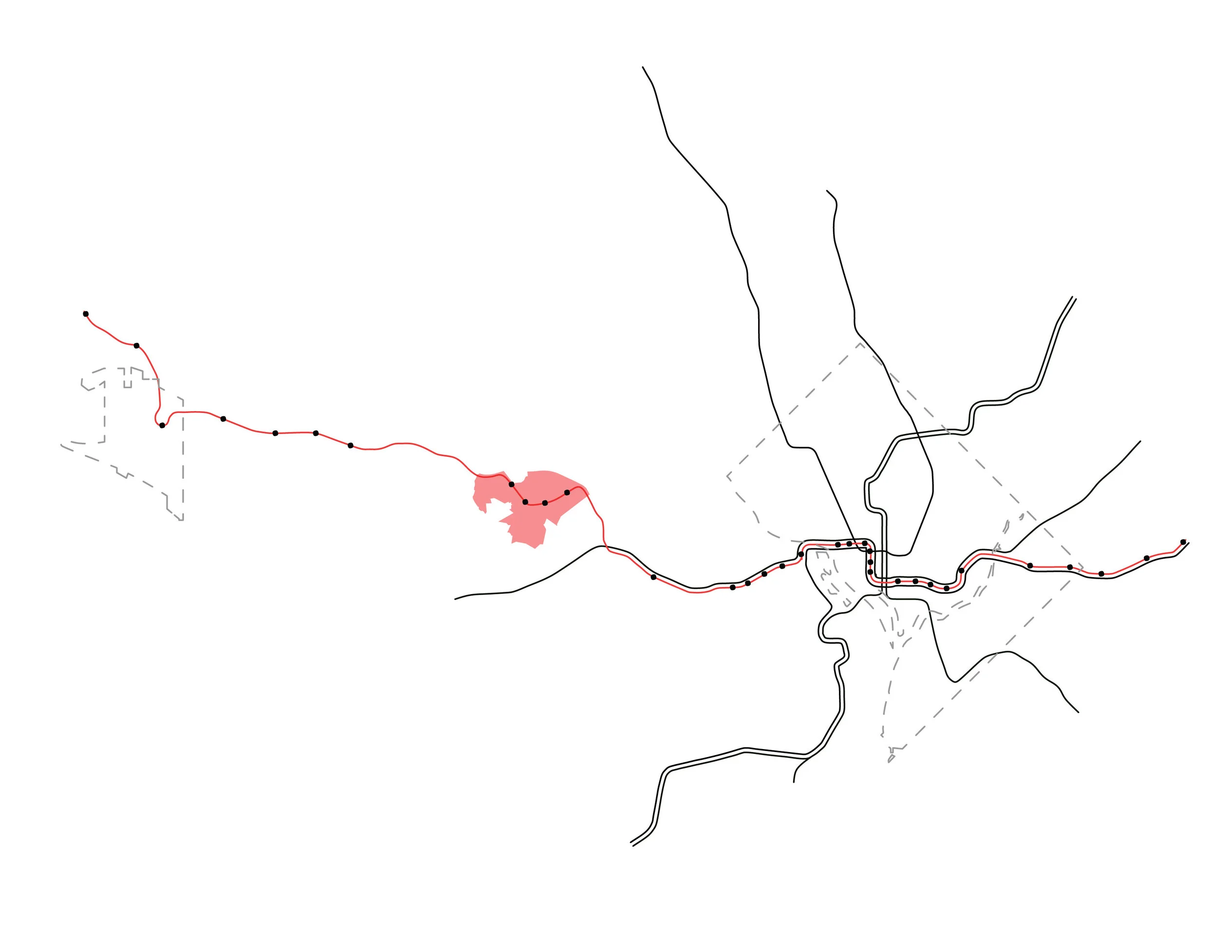
Map showing the scale of DC Metro Lines. The highlighted line is the Silver Line, the most recent and longest line within the Metro system. It spans all the way to Dulles International Airport, intentionally placing 4 stops in Tysons, VA (highlighted in red). Outlines shown are boundaries of Dulles and Washington D.C.
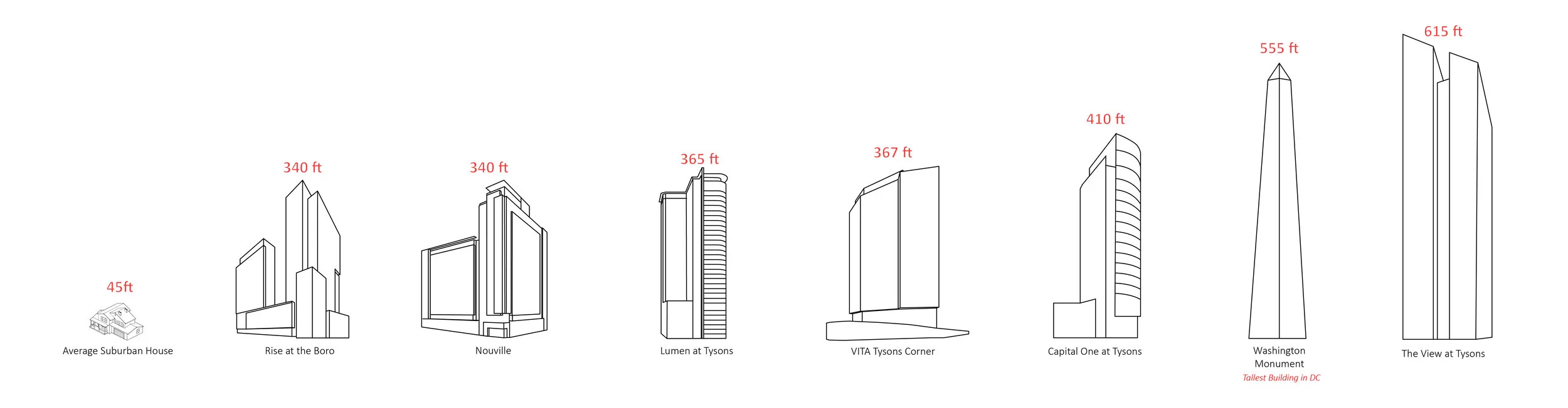
Tysons is the tallest point in Fairfax County, and also is currently constructing many buildings taller than the Washington Monument. According to Fairfax County's Comprehensive Plan, Tysons will ideally become the "downtown of Fairfax County." Tysons is completely surrounded by suburban housing.
Phelps, N. A. (2012). The Growth Machine Stops? Urban Politics and the Making and Remaking of an Edge City. Urban Affairs Review, 48(5), 670–700. https://doi.org/10.1177/1078087412440275
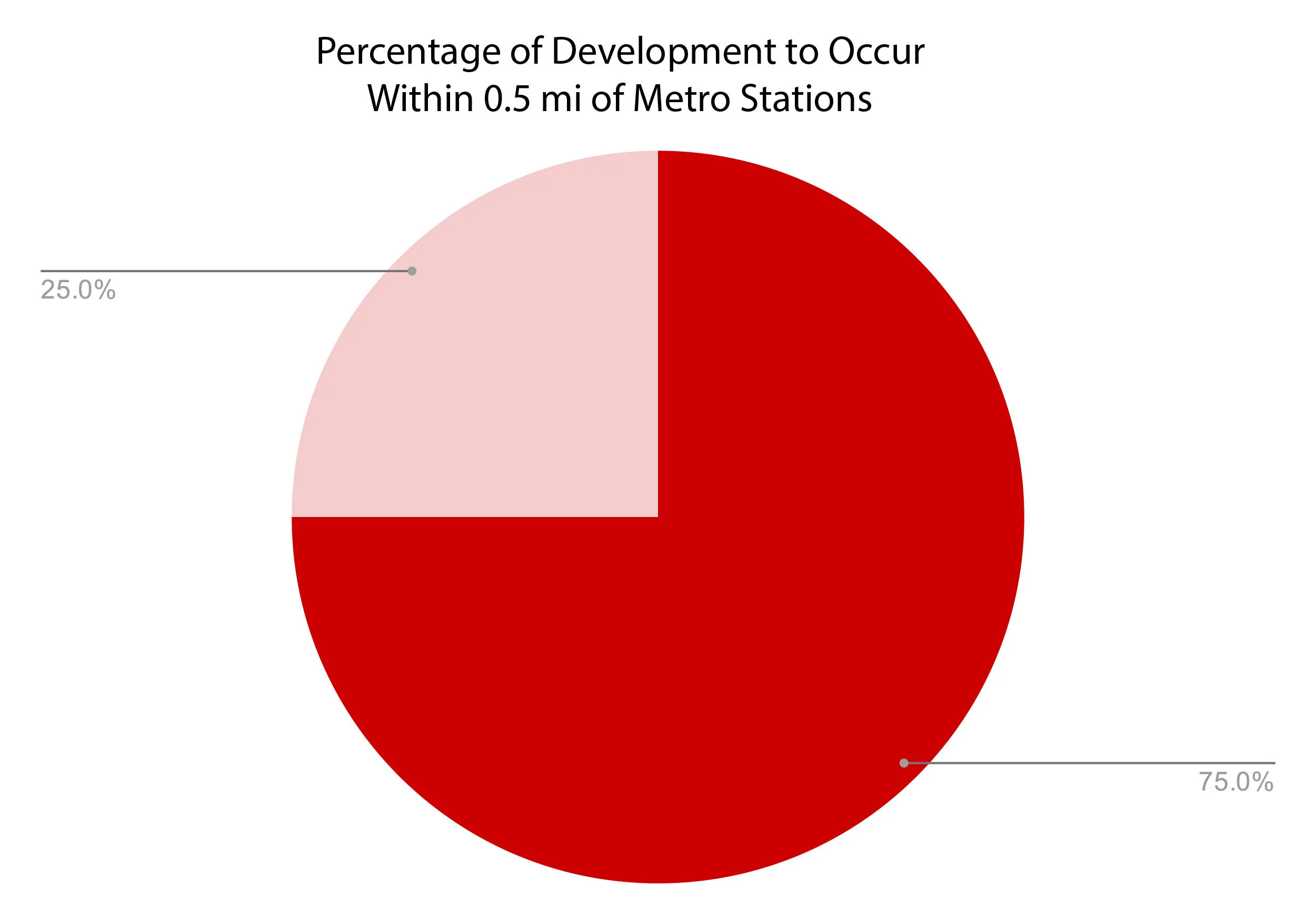
Phelps, N. A. (2012). The Growth Machine Stops? Urban Politics and the Making and Remaking of an Edge City. Urban Affairs Review, 48(5), 670–700. https://doi.org/10.1177/1078087412440275
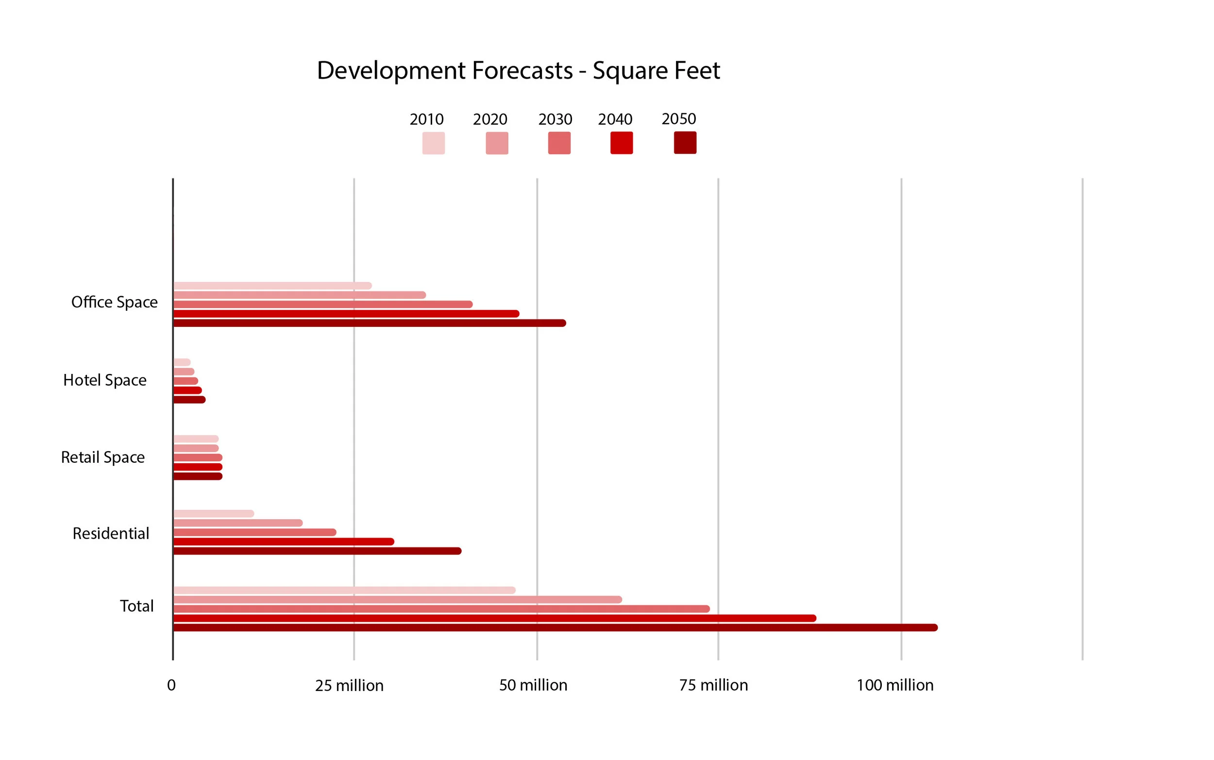
Source: George Mason University Center for Regional Analysis, "Forcasts for Tysons Corner to 2050", by Stephen S. Fuller, PhD in 2008.
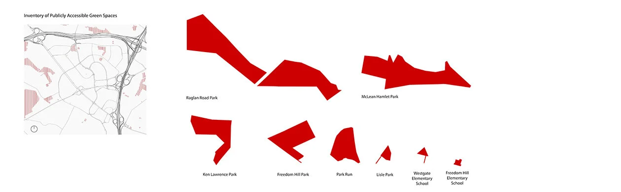
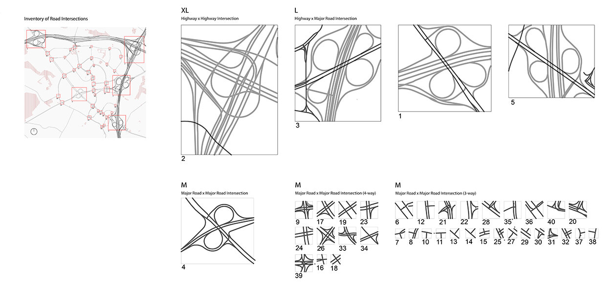
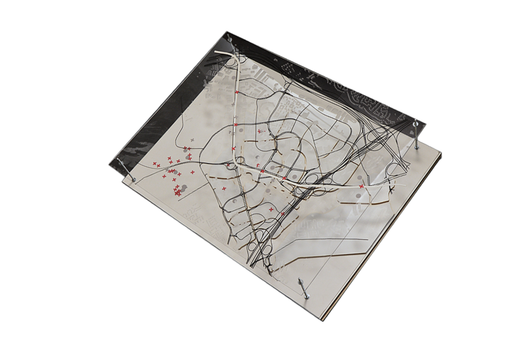
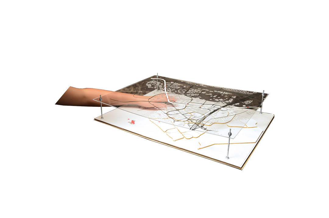
Full Physical Model Showing Analysis of Tysons, Virginia.


03. Master Plan Proposal
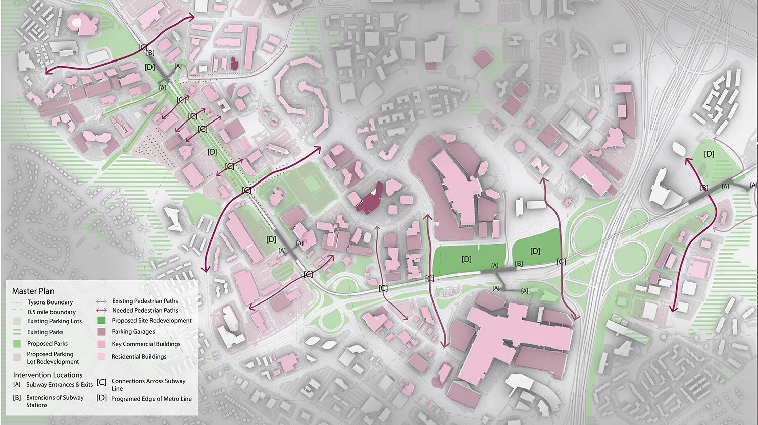
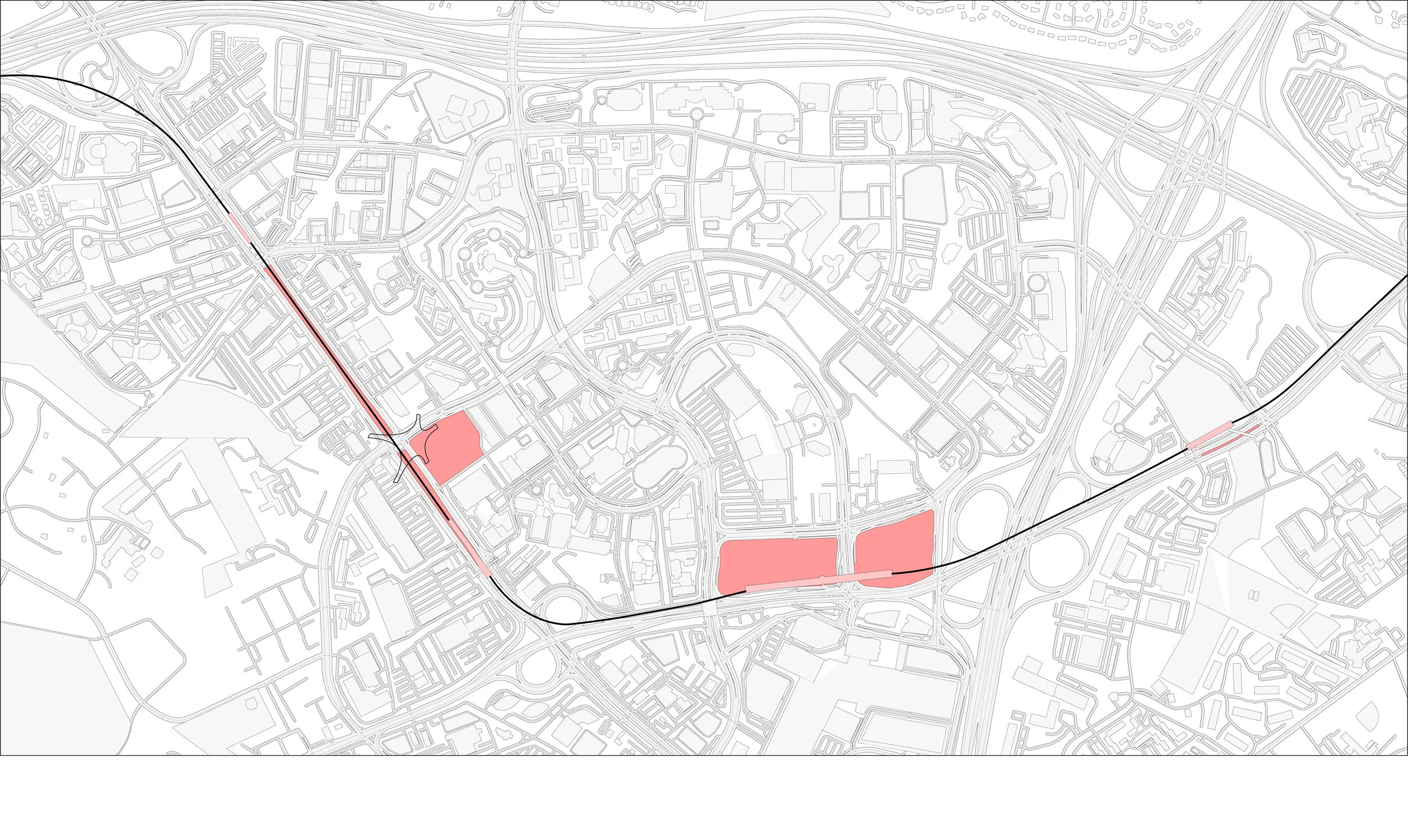
This thesis proposes the re-purposing of the metro silver line, one of the current edges and boundaries of Tysons, which is elevated approximately 30 feet in the air, and runs along major 8-lane road Route-123. The project suggests to develop the line as a programmed edge that facilitates pedestrian connection and greenway expansion through the development of a catalog of architectural interventions that can be placed along the roadway and elevated metro line. Interventions include additions to the entrances/exits of current subway stations, extensions of the subway stations to improve connectivity, connectors that provide access to otherwise bounded destinations, and programmed edges along and under the subway.
04. Intervention Proposals
Programmed edges along the subway line will allow for the subway to connect Tysons, rather than divide.
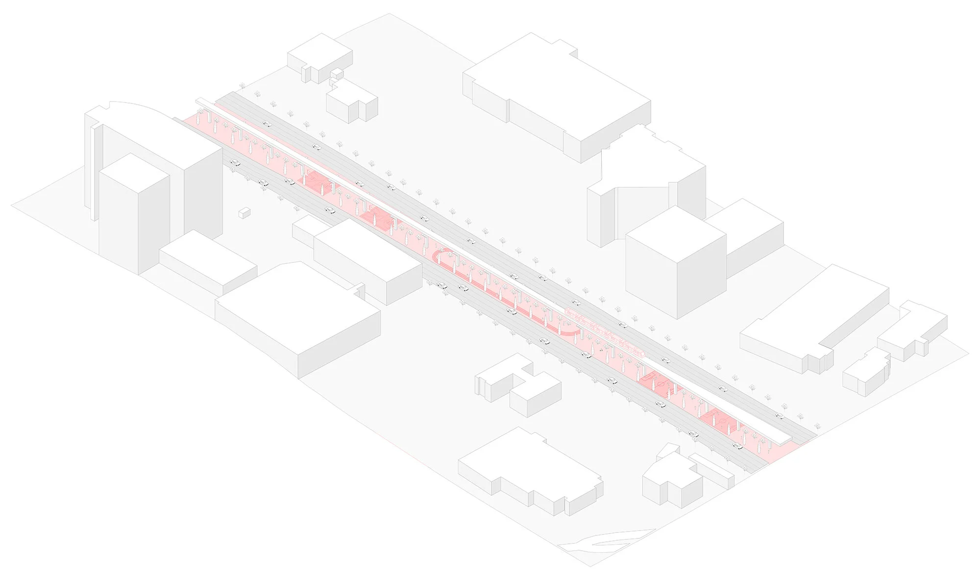
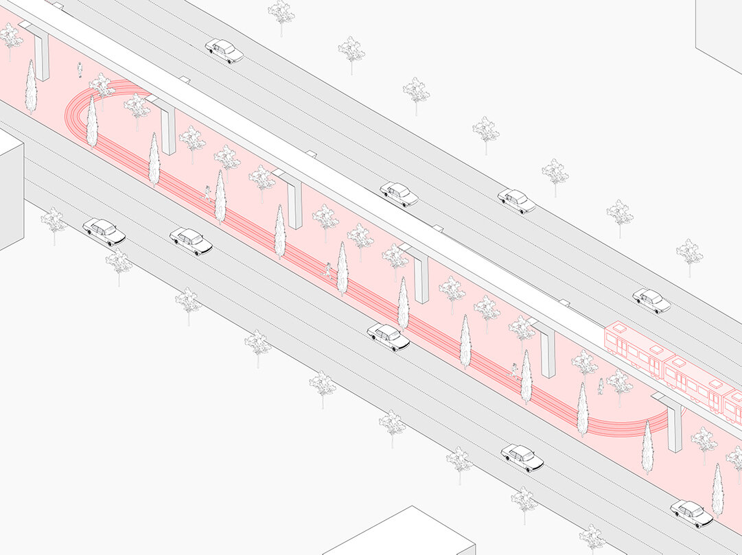
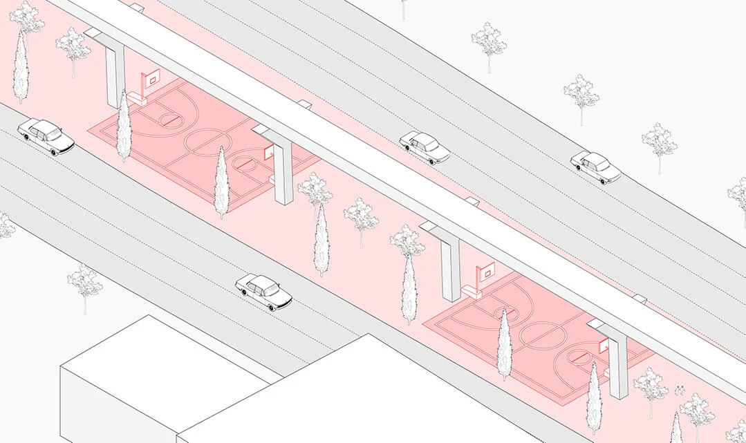
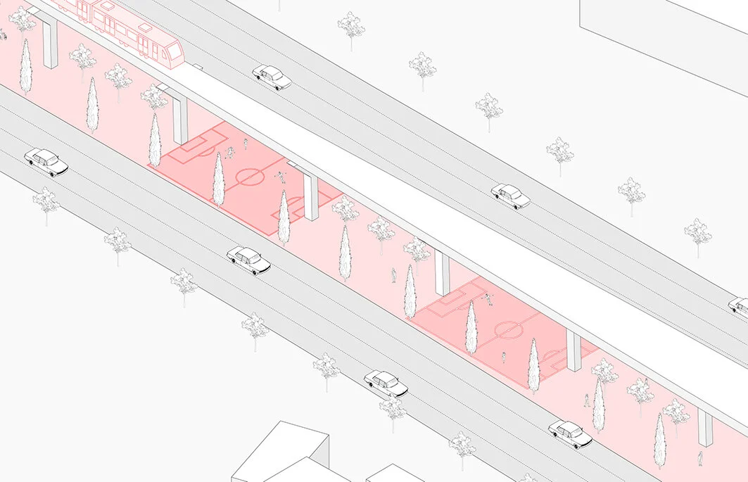
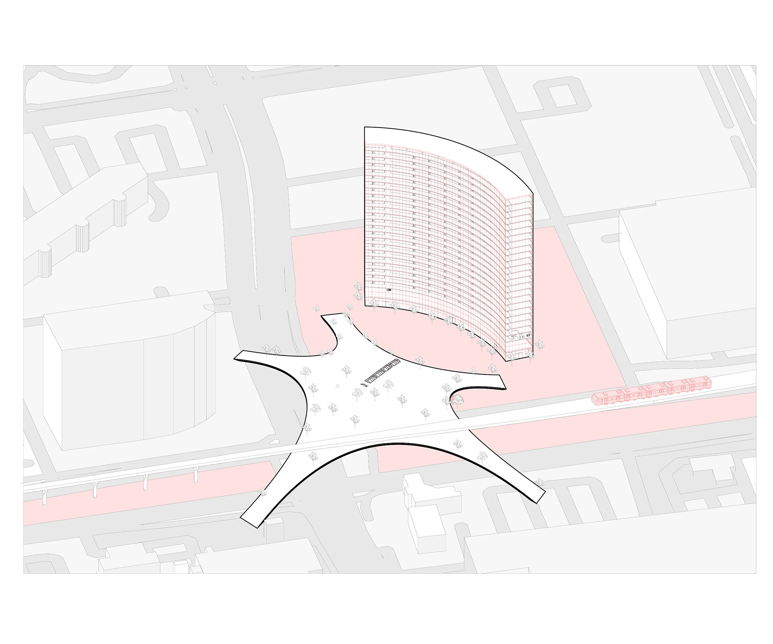
A proposed connection hub facilitates connection across the boundary of major roads and the subway. A proposed residential building makes use of currently empty lots and promotes long term stay in Tysons.
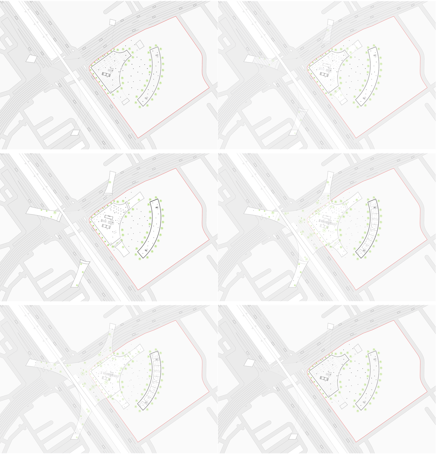
Floors 1 - 3 of Connection Hub and Residential Building Proposals
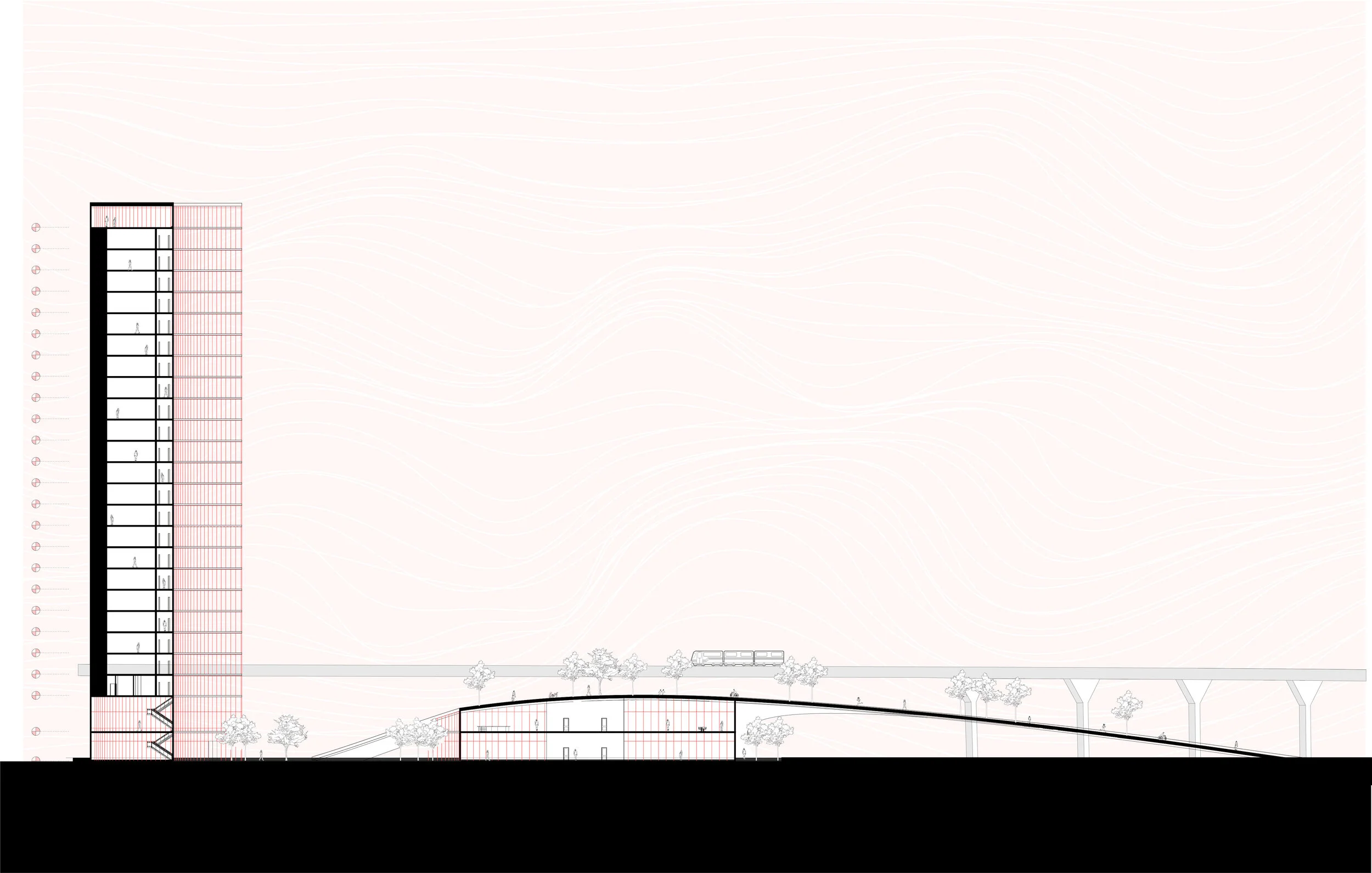
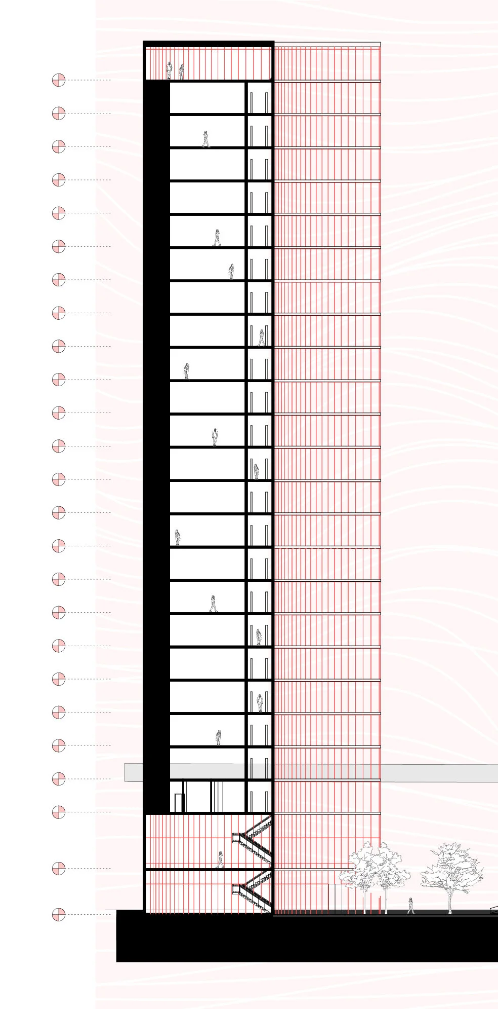
Section of Residential Building and Connection Hub Building Proposals

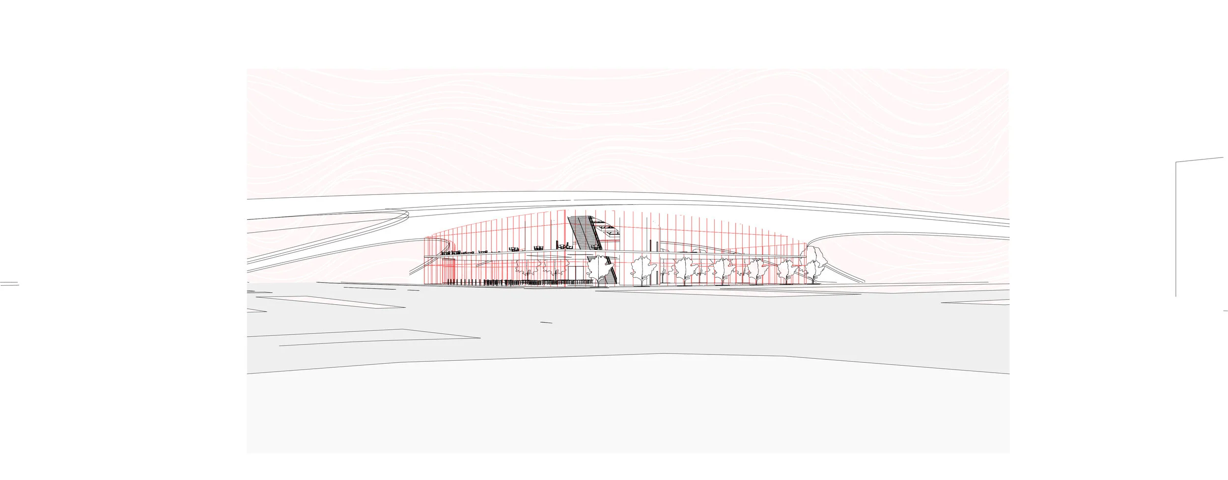
View of Connection Hub From Street Level

Interior of Proposed Connection Hub

Interior of Proposed Connection Hub

View of Connection Hub From Street Level
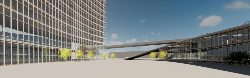
View of Public Square Between New Residential Proposal and Connection Hub

Overview of a Typical Apartment in Proposed Residential Building